Last Updated, March 18, 2025
Introduction
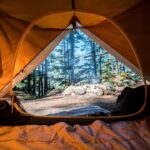
Overlanding—the self-reliant adventure travel to remote destinations where the journey is the primary goal—has gained tremendous popularity among outdoor enthusiasts seeking to explore beyond the conventional tourist routes. Unlike standard off-roading, overlanding emphasizes extended journeys spanning days or weeks, complete with camping and self-sufficiency in some of nature’s most spectacular and challenging environments. This blend of driving skill, wilderness camping, and exploration creates an unparalleled sense of freedom and connection with the natural world.
Oregon stands as a premier overlanding destination, offering an extraordinary diversity of landscapes within a single state. From the lush, moss-draped rainforests of the Coast Range to the high desert plateaus of the eastern regions, Oregon’s varied terrain provides overlanders with dramatically different experiences just a few hours’ drive apart. The state’s extensive network of forest service roads, BLM lands, and designated off-highway vehicle areas creates thousands of miles of potential routes for adventure seekers.
This guide will take you through Oregon’s most remarkable overlanding regions: the rugged Pacific Northwest mountain ranges, the stunning West Coast beaches and forests, the high desert wonders of Central Oregon, and the remote wilderness of Eastern Oregon. Each area offers unique challenges, spectacular views, and unforgettable experiences for overlanders of all skill levels.
Top Overlanding Trails in the Pacific Northwest
Mount Hood Forest Loop
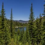
Mount Hood Orbital Trail spans approximately 155 miles, encircling Oregon’s tallest peak through the Mount Hood National Forest. This moderate-difficulty route traverses diverse terrain including dense Douglas fir forests, alpine meadows, and volcanic landscapes. Key landmarks include the historic Timberline Lodge, Mirror Lake, and panoramic viewpoints of neighboring Cascade peaks. A Northwest Forest Pass is required for parking at many trailheads along the route. What makes this trail particularly special is the opportunity to witness the dramatic change in ecosystems as you circumnavigate the mountain, from lush western slopes to the drier eastern terrain.
Three Sisters Backcountry Route covers about 130 miles through the Cascade Range, offering challenging sections that require high-clearance 4WD vehicles. This trail winds through ancient lava flows, subalpine forests, and provides access to numerous alpine lakes. The route passes the striking volcanic formations of the Three Sisters mountains and offers spectacular views of Broken Top and Mount Bachelor. Dispersed camping is available throughout much of the route, but campfires are strictly regulated during summer months. The unique feature of this trail is the opportunity to traverse landscapes shaped by relatively recent volcanic activity, with obsidian fields and cinder cones accessible via short hikes from the main route.
Gifford Pinchot Traverse extends approximately 180 miles through the Gifford Pinchot National Forest in Washington, just north of the Oregon border, making it a perfect extension for overlanders exploring the Pacific Northwest. This route ranges from easy forest roads to moderately technical trails requiring 4WD. Highlights include views of Mount St. Helens, Mount Adams, and access to the Columbia River Gorge. The trail passes through the unique Ape Cave lava tube and offers numerous hot springs for a relaxing soak after a day of driving. A Northwest Forest Pass is required, and some sections may be closed in winter due to snow. The opportunity to witness the ongoing recovery of the landscape from the 1980 Mount St. Helens eruption makes this route particularly educational.
Olympic Peninsula Circuit covers approximately 200 miles of Washington’s Olympic Peninsula, offering Pacific Northwest overlanders the chance to experience temperate rainforests, alpine meadows, and rugged coastlines. Though technically outside Oregon, this moderate-difficulty route makes an excellent addition to a Pacific Northwest overlanding expedition. The route passes through the Hoh Rainforest with its record-setting moss-covered trees, and provides access to high mountain viewpoints and remote beaches. An Olympic National Park pass is required, and tide tables should be consulted for coastal sections. The unique feature of this route is the opportunity to experience four distinct ecosystems—mountains, forests, rivers, and coastline—in a single journey.
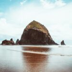
Exploring the West Coast by Overland
Oregon Coast Trail Adventure
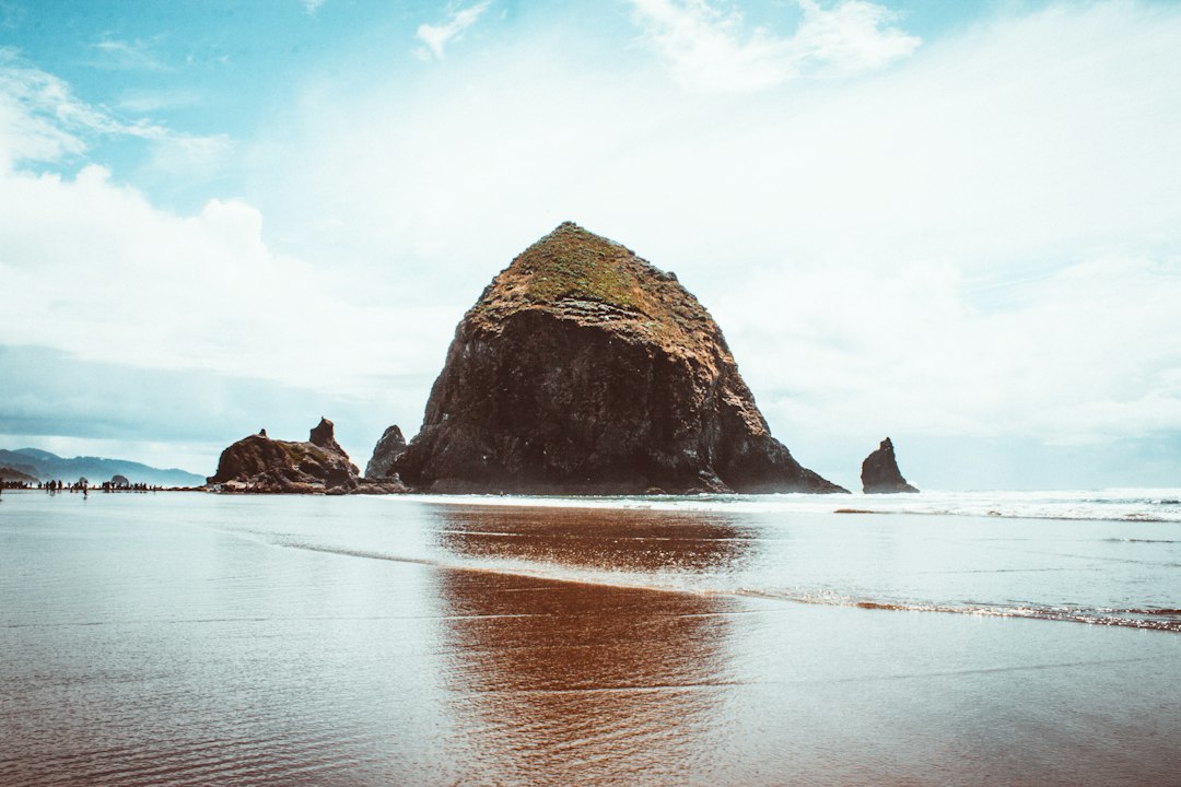
The Oregon Coast overland route offers one of America’s most spectacular driving experiences, combining established highways with less-traveled forest roads that access remote beaches and viewpoints. The 360-mile Oregon Coast Highway (US-101) serves as the backbone of this adventure, with numerous opportunities to venture onto unpaved forest roads that lead to secluded coastal areas inaccessible to typical tourists.
The Siuslaw National Forest Coastal Routes provide some of the best off-highway experiences, with the Siltcoos Beach Access Road and the Cape Perpetua Back Road offering challenging terrain for intermediate overlanders. These routes wind through towering Sitka spruce forests before emerging at breathtaking coastal vistas. The Cape Perpetua section features Thor’s Well and Devil’s Churn, dramatic examples of the powerful interaction between the Pacific Ocean and the volcanic coastline. A valid Oregon State Parks pass or day-use fee is required at most beach access points.
Wildlife viewing opportunities abound along the Oregon Coast overland routes. Roosevelt elk are commonly seen in meadows near the forest edges, particularly in the early morning and evening hours. Harbor seals and sea lions gather at prominent haul-out sites like Simpson Reef near Coos Bay. During migration seasons (December-January and March-May), gray whales can be spotted from numerous elevated viewpoints, with Cape Lookout and Ecola State Park offering some of the best whale watching opportunities.
Must-see viewpoints for West Coast overlanders include the Cape Blanco Lighthouse (Oregon’s westernmost point), Heceta Head with its historic lighthouse and sweeping ocean views, and the Samuel H. Boardman State Scenic Corridor with its numerous pullouts showcasing natural bridges and sea stacks. For those with capable vehicles, the remote Whiskey Run Road near Bandon provides access to secluded beaches with world-class agate hunting, while the steep, switchbacking Mount Hebo Road rewards drivers with 360-degree views encompassing both the ocean and the Cascade Range on clear days.
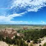
Overlanding Through Central Oregon
High Desert Discovery Routes
| Trail Name | Distance (miles) | Duration (days) | Difficulty | Vehicle Type | Campgrounds | Wildlife | Scenic Views | Permits |
|---|---|---|---|---|---|---|---|---|
| Deschutes Back Country Byway | 120 | 2-3 | Moderate | High-clearance 4WD | 5 | Pronghorn, eagles, deer | Smith Rock, Cascade peaks | None required |
| Crack-in-the-Ground Loop | 85 | 1-2 | Easy to Moderate | Any high-clearance | 3 | Jackrabbits, coyotes, birds of prey | Fort Rock, Christmas Valley | None required |
| Steens Mountain Loop | 140 | 3-4 | Difficult | High-clearance 4WD with low range | 4 | Bighorn sheep, wild horses, hawks | Kiger Gorge, Alvord Desert | None required |
| Ochoco Mountains Traverse | 160 | 3 | Moderate to Difficult | High-clearance 4WD | 6 | Elk, mule deer, bears | Painted Hills, Lookout Mountain | Northwest Forest Pass |
Central Oregon’s high desert provides some of the state’s most otherworldly overlanding experiences. The Oregon Outback Route extends approximately 170 miles from Bend to the Nevada border, traversing spectacular high desert terrain. This route follows a combination of gravel roads and two-track trails through sagebrush plains, ancient juniper forests, and dramatic rimrock formations. The route passes through the Fort Rock-Christmas Valley area, where overlanders can explore unique geological features including Fort Rock (an ancient volcanic tuff ring) and Crack-in-the-Ground (a volcanic fissure you can walk through).
The Three Sisters Volcanic Byway provides access to the volcanic wonders of the Newberry National Volcanic Monument. This 120-mile route incorporates forest roads FR-40 and FR-42, passing lava flows, obsidian fields, and crater lakes. High points include the Lava Cast Forest, Lava River Cave, and the obsidian flow trail—a 700-foot-thick flow of black glass that represents one of the youngest geological features in the Cascades. Dispersed camping is available throughout much of the route on national forest land, though designated sites at East Lake and Paulina Lake offer amenities like vault toilets and water.
For the more advanced overlander, the Steens Mountain Loop offers a challenging high-elevation route that reaches nearly 10,000 feet at its summit. This 59-mile loop road (closed in winter) takes drivers through multiple ecological zones and provides access to several dramatic gorges carved by ancient glaciers. The eastern side of Steens Mountain drops almost vertically to the Alvord Desert, creating one of Oregon’s most dramatic landscapes. Nearby, the Alvord Desert playa offers unique camping on the dry lakebed (when conditions permit) and access to several natural hot springs, including the popular Alvord Hot Springs.
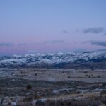
Off-Road Adventures in Eastern Oregon
Wilderness Frontier Exploration
Eastern Oregon represents the state’s final frontier for overlanding, with vast expanses of public land, minimal population, and challenging routes that reward adventurers with pristine wilderness experiences. The Blue Mountains Loop connects the communities of La Grande, Baker City, and Prairie City via forest roads and two-track trails through the Wallowa-Whitman and Malheur National Forests. This 220-mile route traverses pine forests, subalpine meadows, and high mountain passes, with numerous opportunities for dispersed camping away from civilization.
The terrain in Eastern Oregon differs significantly from the western regions, with drier conditions creating open ponderosa pine forests rather than the dense Douglas fir stands found west of the Cascades. The region’s lower precipitation means trails remain passable for longer seasons, though summer thunderstorms can create flash flood dangers in slot canyons and dry washes. Overlanders should carry extra water and fuel, as services are limited in this remote region.
Eastern Oregon’s rich mining and ranching history provides numerous points of interest for overlanders. The Elkhorn Drive Scenic Byway passes through the historic gold mining communities of Sumpter and Granite, where visitors can view preserved stamp mills and dredges. The route also passes the ghost town of Greenhorn, now largely abandoned but open for exploration. Further east, the Hells Canyon Overlook Route provides access to viewpoints overlooking North America’s deepest river gorge, carved by the Snake River along the Oregon-Idaho border.
Unique geological features abound in Eastern Oregon’s backcountry. The Leslie Gulch Trail showcases spectacular honeycombed rhyolite formations created by volcanic activity 15 million years ago. The Owyhee Canyonlands Route traverses a landscape often compared to the Grand Canyon, with multicolored cliff walls, spires, and natural arches accessible via challenging 4WD trails. The region’s geological isolation has created distinctive landforms found nowhere else in Oregon, making it a paradise for overlanders seeking truly unique experiences off the beaten path.
Overlanding Safety Tips for Oregon’s Backcountry
- Communication Planning: Cell coverage is extremely limited in many of Oregon’s best overlanding regions. Carry a satellite communicator (Garmin inReach, SPOT, etc.) for emergency communication, and always inform someone of your planned route and expected return date.
- Water Crossing Assessment: Oregon’s mountain regions contain numerous stream crossings that can become dangerous after rainfall or during spring snowmelt. Always walk water crossings first to check depth and bottom composition, and be prepared to turn around if conditions are questionable.
- Wildlife Awareness: Eastern and Central Oregon contain significant black bear populations, while the northeast corner of the state has recovering wolf populations. Store food securely, make noise when hiking, and carry bear spray in high-density bear areas. In Western Oregon, be alert for Roosevelt elk on roads, especially at dawn and dusk.
- Fire Safety and Awareness: Oregon’s dry summers create extreme fire danger, with many regions implementing campfire bans from July through September. Carry a shovel and extra water for extinguishing fires completely, check current fire restrictions before your trip, and avoid parking on dry grass that could ignite from contact with hot exhaust components.
- Seasonal Weather Preparedness: Mountain passes can receive snow as early as September and as late as June. Desert regions can experience temperature swings of 40+ degrees between day and night. Carry appropriate clothing layers, check weather forecasts before departure, and be prepared for rapidly changing conditions, especially in the Cascade Range.
- Navigation Redundancy: Many forest service and BLM roads aren’t accurately represented on standard GPS systems. Carry paper maps, download offline maps to multiple devices, and consider a dedicated GPS unit with topographic maps. Motor Vehicle Use Maps (MVUMs) from the Forest Service show which roads are legally open to vehicles.
- Recovery Equipment: Oregon’s varied terrain requires comprehensive recovery gear. At minimum, carry a full-sized spare tire, tire repair kit, portable air compressor, recovery straps, and a shovel. For more technical routes, consider recovery boards, a high-lift jack, and a winch.
Best Time of Year for Overlanding in Oregon
Spring (April-June)
Spring offers spectacular wildflower displays across Oregon’s diverse ecosystems, with desert regions blooming as early as April and mountain meadows erupting with color by June. Water levels are high during this season, making stream crossings more challenging but waterfalls more impressive. In the mountains, snow typically blocks high-elevation routes until late June, while lower elevations experience frequent rainfall that can create muddy conditions. The coast experiences fewer visitors during spring, making it an excellent time for beach overlanding, though rain remains common. Central Oregon’s high desert provides the most reliable spring overlanding, with moderate temperatures and blooming landscapes.
Summer (July-September)
Summer represents peak season for Oregon overlanding, with all mountain passes typically open by mid-July and remaining accessible through September. Conditions are dry and dusty on most routes, requiring reduced tire pressure on gravel roads for comfort and traction. Daytime temperatures can exceed 100°F in Eastern and Central Oregon, while coastal regions remain cool with frequent morning fog. Fire restrictions are common during this period, often prohibiting campfires and sometimes closing certain high-risk areas entirely. Permits and designated campsites can be difficult to secure during this peak season, particularly in popular areas like Mount Hood and the Three Sisters Wilderness, so advance planning is essential.
Fall (October-November)
Fall offers a sweet spot for many Oregon overlanding routes, with decreased crowds, cooler temperatures, and spectacular foliage, particularly in the mixed forests of the Cascade foothills and Blue Mountains. Wildlife activity increases during this season as animals prepare for winter, providing excellent viewing opportunities. Weather becomes increasingly unpredictable, with potential for early snowfall in mountain regions by late October. Most facilities and campgrounds remain open through October, transitioning to reduced services in November. Desert regions of Central and Eastern Oregon offer particularly pleasant conditions during fall, with moderate daytime temperatures and crisp, clear nights ideal for stargazing.
Winter (December-March)
Winter severely limits overlanding opportunities in Oregon’s mountains, with most high-elevation routes closed by snow from December through May. However, dedicated winter overlanders with properly equipped vehicles can access unique experiences on designated snow routes. The Oregon Coast remains accessible year-round, offering dramatic storm watching opportunities and empty beaches, though rainfall is substantial and landslides occasionally close sections of coastal roads. Central Oregon’s high desert provides some winter overlanding possibilities, with routes around Bend and Prineville often remaining accessible due to the rain shadow effect of the Cascade Range. For winter overlanding, focus on lower elevation routes in the Willamette Valley, Southern Oregon, and the Columbia River Gorge.
Essential Gear for Overlanding in Oregon
- Vehicle Recovery Equipment: Oregon’s diverse terrain demands comprehensive recovery capability. Carry recovery boards, a winch or come-along, recovery straps with proper shackles, a high-lift jack, tire repair kit, portable air compressor, and a full-sized spare tire.
- Navigation Tools: Bring detailed paper maps of your route (especially Motor Vehicle Use Maps from the Forest Service), a GPS device with topographic mapping, and downloaded offline maps on a secondary device. A compass and the knowledge to use it remain essential backups.
- Water Management System: Carry a minimum of 2 gallons of water per person per day, plus additional water for vehicle cooling systems and emergency fire suppression. A water filtration system allows replenishment from Oregon’s abundant streams and lakes.
- Climate-Appropriate Clothing: Pack for temperature variations of 40+ degrees within a single day, especially in desert regions. Essential items include waterproof outer layers, moisture-wicking base layers, insulating mid-layers, sturdy hiking boots, sun protection (hats, sunglasses, sunscreen), and extra dry clothing.
- Communication Devices: Cell service is nonexistent in many prime overlanding areas. Carry a satellite messenger/SOS device (Garmin inReach, SPOT, etc.), and consider a CB or ham radio for convoy communication.
- Seasonal Specifics: Snow chains or cables are legally required to be carried in mountain areas from November through March (even if not needed). For summer trips, a high-quality air filtration mask provides protection during wildfire season when smoke can become hazardous.
- Wildlife Protection: Store food in wildlife-resistant containers, especially in bear country. Carry bear spray when in Central and Eastern Oregon forests, and know how to use it.
- Regional Permits and Passes: Keep Northwest Forest Passes, Oregon State Park passes, Sno-Park permits (for winter), and any specific area permits easily accessible in your vehicle.
Planning Your Oregon Overlanding Adventure
- Research and Select Routes Based on Your Vehicle’s Capabilities: Be realistic about what your vehicle can handle. For stock SUVs or trucks, start with forest service roads and well-established trails before progressing to more technical routes that might require additional modifications.
- Acquire Necessary Maps and Permits: Download Motor Vehicle Use Maps (MVUMs) from the US Forest Service website for each forest you’ll traverse. Purchase a Northwest Forest Pass for recreation sites, and research specific permits needed for special areas like the Oregon Dunes or certain wilderness areas.
- Create a Detailed Itinerary with Contingencies: Plan daily mileage conservatively, accounting for difficult terrain that might limit you to 5-10 miles per hour. Identify alternative routes and bail-out points in case of trail closures, vehicle issues, or weather changes.
- Perform Comprehensive Vehicle Preparation: Schedule a thorough maintenance check 2-3 weeks before your trip (allowing time for any necessary repairs). Check all fluids, filters, belts, hoses, suspension components, and tire condition. Consider a transmission cooler addition for automatic transmissions tackling mountain routes.
- Establish Communication Protocols and Check-in Procedures: Provide your detailed itinerary to a reliable contact not on the trip. Establish check-in times and procedures, and clear instructions on when and how to alert authorities if you miss check-ins.
- Practice Essential Skills Before Your Trip: If you’re new to overlanding, practice essential skills like tire changing, vehicle recovery, and navigation in a controlled environment before tackling remote trails.
- Research Seasonal Considerations for Your Route: Check expected weather conditions, potential snow levels for mountain routes, fire restrictions for summer travel, and seasonal road closures. The Oregon Department of Transportation and Forest Service websites provide current condition reports.
- Prepare for Regional Environmental Challenges: For coastal routes, understand tide tables and tsunami evacuation routes. For desert sections, plan for extreme temperature variations and limited water sources. For mountain regions, be prepared for sudden weather changes and potential snow even in summer months.
Overlanding Etiquette
- Practice Leave No Trace Principles: Pack out all trash, including food scraps and toilet paper. Use established fire rings when fires are permitted, and fully extinguish any campfires. Stay on designated routes to prevent vegetation damage and soil erosion, especially in fragile desert ecosystems.
- Respect Gate Protocols and Private Property: Leave gates as you found them (open or closed). Many Oregon overlanding routes pass through a checkerboard of public and private land; use Motor Vehicle Use Maps to ensure you remain on legal routes and respect all posted private property boundaries.
- Minimize Impact on Local Communities: Support local businesses when resupplying in small towns. Keep noise to a minimum when passing through residential areas or camping near communities. Be courteous when sharing fueling stations and other facilities that may not regularly see heavy overland traffic.
- Follow Proper Wildlife Viewing Practices: Maintain safe distances from all wildlife (minimum 100 yards from predators, 25 yards from large herbivores). Never feed wildlife, secure all food and trash, and observe animals only briefly before moving on to minimize stress and habituation.
- Share Trails Respectfully with Other Users: Yield to non-motorized trail users including hikers, mountain bikers, and equestrians. When encountering other vehicles on narrow routes, the vehicle traveling uphill generally has right-of-way. Communicate clearly with universal hand signals when passing.
- Reduce Campsite Impact: Use established campsites whenever possible. For dispersed camping, set up on durable surfaces at least 200 feet from water sources. In popular areas, consider camping in sites showing previous use rather than creating new impact areas.
Frequently Asked Questions
What type of vehicle do I need for overlanding in Oregon?
For most forest service roads and established routes, any high-clearance SUV or truck will suffice. However, more technical trails like the Steens Mountain Loop or sections of the Blue Mountains routes require true 4WD with low-range gearing. All-terrain tires are strongly recommended for any Oregon overlanding, as road surfaces can change dramatically with weather conditions. For extreme routes, vehicles with aftermarket suspension lifts, skid plates, and locking differentials provide additional capability and safety margins.
Do I need permits for overlanding in Oregon?
Many recreation sites in national forests require a Northwest Forest Pass ($30 annually or $5 per day). Oregon State Parks charge day-use fees for beach access and facilities. Some specific areas like the Oregon Dunes require special permits. For dispersed camping on most national forest and BLM land, no specific permits are needed, though some wilderness areas have quota systems requiring advance reservations. Always check the specific requirements for your planned route with the managing agency (Forest Service, BLM, State Parks, etc.).
When are Oregon’s mountain passes typically snow-free?
Most high Cascade passes become reliably snow-free between mid-June and early July, depending on the previous winter’s snowpack and spring temperatures. Some very high routes, like sections of the Three Sisters Backcountry Route above 7,000 feet, may retain snow patches into August during heavy snow years. Fall snow typically begins accumulating by late October, with passes often closing by mid-November. Lower elevation forest roads generally remain accessible from May through October.
How should I handle wildlife encounters while overlanding in Oregon?
Oregon is home to black bears, cougars, elk, and in the northeastern corner, wolves. For predators, maintain distance, never approach, and carry bear spray in known bear habitat. Make noise while hiking to avoid surprising animals. For elk and deer, be especially vigilant while driving during dawn and dusk hours when they’re most active. Store food securely in hard-sided containers or hanging systems, particularly in bear country. Never feed any wildlife, regardless of species.
What emergency services are available in remote overlanding areas?
Cell service is extremely limited or nonexistent in many prime overlanding regions of Oregon. Search and rescue operations are typically coordinated by county sheriff departments, often with significant response times in remote areas. For emergency communication, a satellite messenger device (Garmin inReach, SPOT, etc.) is strongly recommended. Some very remote regions in Eastern Oregon may be several hours from the nearest emergency medical services, making self-sufficiency and first aid knowledge essential.
How do I find legal dispersed camping locations in Oregon?
On national forest and BLM land, dispersed camping is generally permitted except where specifically prohibited. Look for previously used sites with established fire rings to minimize impact. Camp at least 200 feet from water sources and 100 feet from trails. Most dispersed camping allows a maximum stay of 14 days within a 28-day period. Motor Vehicle Use Maps (available free from Forest Service offices or websites) show roads where dispersed camping is permitted. Some popular areas have moved to designated dispersed camping only, requiring you to use established sites marked on maps.
What are the regulations regarding campfires in Oregon?
Campfire regulations vary dramatically by season and location. During the height of fire season (typically July-September), complete fire bans are common across much of the state, particularly in Central and Eastern Oregon. Even when fires are permitted, they must be in established fire rings, attended at all times, and fully extinguished. Always check current fire restrictions before your trip through the Oregon Department of Forestry website or by contacting the local ranger district office for your destination. Portable propane stoves are typically allowed even during fire bans, making them a reliable cooking option year-round.